27-07-2010
Today we motored from Egersund to Stavanger. A trip of 54 miles.
As promised there was hardly any wind (except from later that afternoon)so the sea was calm and we could go the whole distance instead of having a stop between in Tananger.
It was a rather uneventfull journey apart from the fact that we passed our most western point at the west cardinal buoy "Jaerens rev".
Jaerens rev buoy.Most western point of the journey.
Jaeren is the area we passed and its a flat part of norway in front of the mouintains where much of the food is cultured.
View at jaeren and the mountains behind.
The rest of the trip was as said rather uneventfull and we arrived at the new (2007) Boreviken guestharbour at just after 18.00 .
Boreviken Gjesthavnen
Normally Stavanger has two guest harbours but because of a big food festival "Glatmat" the old Vagen harbour was blocked for visitors.
We were very lucky to get a berth at the Boreviken harbour.
The old Vagen Gjesthavnen
Today two gigantic cruise ships arrived in the Vagen harbour which is almost totally filled by them. Cruise liners regularly visit Stavanger.
One was the Dutch "Werkendam" from the resurrected "Holland America Lijn".
So there where lots of Dutch talking people in the town.
Dutch cruise ship Werkendam
The other ship was an even bigger Italian cruiser.
We will stay another day in Stavanger and then go to the Lysefjord which is one of the most famous fjords in norway.
To be continued.
zaterdag 31 juli 2010
zondag 25 juli 2010
Flekkefjord to E(i)gersund
25-07-2010
YELLOWDREAM ROUTE weergeven op een grotere kaart
Today we motored from Flekkefjord to Egersund . Motored not because the absence of wind but because the wind was right on the nose ( I know it's never o.k. for a sailer).
The trip was a bit bumpy but the weather was fine with a clear blue sky.
There is one little question that always comes up when we sail this part.
At about 2/3 of the trip ( the third sun from the end) there is a rock with a remarkeble white top on it.
Rock with white top.You can also see that the sea is a bit bumpy.
Who did it ( if someone did).
Looking at it through my binoculars it lookes as if there are dripstripes coming from the top.
maybe its a custom of everybody who climbs the top to take a pot of paint with him(?!).
However it also could be natural because in this area there is a lot of titanium ore present that also looks whitish.
Maybe one day i will know.
We stay a day in Egersund.Tomorrow the wind will be on the nose again , but Tuesday it will be lighter and on the beam . Because the part between egersund and Tananger is the only really exposed piece of the Norwegian westcoast and 50 miles long we want a nice trip!
Also I have to do an oil exchange. Off course (!) my electric pump I use for it did break so I had to find a new one. Lucky enough the local chandler had the handpumps most people use for it so I could do the job.
So tomorrow we will go for Tananger or , if we are fast enough , to Stavanger where we will be between the Skjeres(skerries) again.
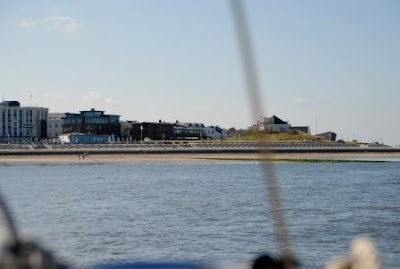
The Gjestehavn (guestharbour) of Egersund.
YELLOWDREAM in Egersund Gjestehavn.
zaterdag 24 juli 2010
From Farsund to Flekkefjord
YELLOWDREAM ROUTE weergeven op een grotere kaart
24-07-2010
Today we sail (actually motor as you can imagine from the routemap) from farsund to Flekkefjord.
globally its only a short distance but you must go all the way around the flat peninsula of Lista to reach the entrance of flekkefjord.
View over Lista to the mountains.
Behind Lista you enter the Fjord area of Norway.
Norway fjords , here we are again!
Again there was no wind at all so we motored all the way. ( may be some kind of curse?).
At former occasions we always bypassed Flekkefjord because its a bit out of the way when you want to go further North but this time we decided to pay the small town a visit.
We were pleased to hear that also here the first day is free of charge.
Actually you have to pay for the showers but they also wor\k without because there is no automat (phew pfew YELLOWDREAM).
Flekkefjord appoach
Tomorrow we will go on to Egersund which is about 37 miles away.
to be continued
From Mandal to farsund and passing "THE CAPE"
23-07-2010
YELLOWDREAM ROUTE weergeven op een grotere kaart
Today we sailed ( yes we did sail most of the day!) from mandal to farsund.
Doing so one has to pass the "famous" Cape Lindesnes".
It's not cape Horn but anyway , its a real cape!
Cape Lindesnes , just passed
This time , although the wind was rather modest, there were some big waves around the cape with overfalls and up to 3 meters high (guess). Only about half a mile before and after the cape were affected so it must have something to do with currents or wave patterns meeting. We did pass the cape 8 times before , even in more wind and never saw such waves.
The rest was a nice sail with an average of 4.5 knots and wind from the aft quarters.
We arrived at farsund about 16.00 .
Farsund appoach
Yachts can moor at the town quay with all services and a supermarket next to it. And its all for free!!( exept the showers).
Farsund yacht harbour
Farsund seen from free yacht harbour
Tomorrow we will continue with a short 32 mile trip to Flekkefjord .
donderdag 22 juli 2010
Crossing the Skagerrak.
21-07-2010
Today we crossed the Skagerrak to Mandal in southern Norway.
It's always a special trip although we did it 12 times before.
A steady weather is a must because you will be at sea for up to 13 hours.
Two years ago we were surprised by a force 7 in the afternoon and had to divert to another harbour which was 15 miles further away.
This time the weather was very easy. There was a force 3-4 wind however right at the tail so we could only do about 3-4 knots making sailing in the available time no option and we had to motor the whole 67 miles!
By the way : don't bother the lack of the line in the google route picture. It did not work with the internet connection in mandal.
The sea was rather smooth and the weather fine so it was a very nice ,uneventful trip.
Arriving in Mandal we saw that there were some changes related to the situation 5 years ago when we were there the last time.
The Sjosanden Marina has been demolished (its still in the new pilots) and yachts now have to moore in the city harbour on floating pontoons.
Payment has to be done with an automat which also accepts foreign credit cards.
All services are available and there is a free wlan hotspot in the gjest harbor.
Mandal is a nice town with a lot of shops and some nice cafe's and restaurants.
View over Mandal out to the Skagerrak from the viewpoint which looks over the city.
Inland view from the viewpoint.
Westward view.
to be continued
woensdag 21 juli 2010
Thyboron to Hanstholm
20-07-2010
Today we sailed from Thyboron to Hanstholm at the very top of Danmark.
Although most pilots write that Hanstholm Harbour does not allow yachts to enter we were there several times since 1997 and never got any complaint. However there are no services at all (apart from a doubtful public toilet) but there is a supermarket , a cafetaria and a hotel in the harbour and a shopping center up the hill, a 15 min walk away. Hanstholm is a very suitable departure port for a crossing of the Skagerak to Mandal in Norway because it shortens the way from Thyboron from 90to 65 miles making a daytrip is possible.
View over hanstholm harbour.
Yachts are allowed to take a berth at the very end of the harbour as can be seen on the foto.This time our place was even confirmed by the harbour master (it was a women so maybe it should be mistress?).
Yachts in Hanstholm harbour with a special place for YELLOWDREAM ( the tiny yellow spot right from the middle).
In the harbour area thre are a few shops among them a supermarket so a longer stay in case of bad weather is no problem.
The town of Hanstholm itself is over the hilltop at the foto and a 15 minute walk. You can use a long starwy that covers most of the hill.
Hanstholm is just over the cliff.
If the weather stays as promised we will make the Skagerrak to Mandal crossing tomorrow .
zondag 18 juli 2010
Leaving Hvide Sande for Thyboron
17-07-2010
We are on our way again!
After two days of strong winds up to force 7 ( > 25 knots) the weather is stabilizing and the wind gone back to a nice force 4.
Today we will sail to Thyboron at 43 miles. Thyboron is situated at the entrance of the Limfjord (named after the lime cliffs) which is a chain of lakes and canals from the western to the eastern coast of danmark.
Among sailers its often used to escape bad west wind weather in the Northsea and go to the Baltic instead.
We had a nice sail most of the day but in the wind decreased so much that we had to use the engine again.
The steep cliffs of bovbjerg with the Bovbjerg lighthouse were a major waypoint.
The village of Bovbjerg is wonderfully situated besides the cliffs.
However about 8 miles before Thyboron the wind increased firmly to force 6 and we had a very fast sail under main only with a tail wind.
After a 9 hour sail we entered the harbour of Thyboron and got a nice place right in front of the service building annex fish restaurant which is the old fish auction building.
The small city of Thyboron is situated at the Western entrance of the limfjord.This entrance originates from a storm about 100 years ago when the dunes between the North sea and the inner limfjord where broken. Later this was transformed into the Thyboron canal which now forms the entrance.Thyboron mainly is a fishing town but tourism is coming in more and more.
The entrance of the Thyboron canal.
The yacht harbour with the restaurant/service building at the back.
The beach is just next to the harbour. Only at strong west winds it gets a bit "sandy"!
After a short stay to fill up with food , diesel and camping gaz (which is not available in norway!) we will sail on to Hanstholm , the most North-west harbour of Danmark.
To be continued!
donderdag 15 juli 2010
Stuck in Hvide sande
15-07-2010
Hi Folks,
Its been some time since the last blog but its quite difficult to get an internet connection.
We are in Hvide Sande now and waiting for better weather , that is less wind because its blowing beaufort 7 now.
I'm writing this in the local bakery (that's no joke!) where there are two free internet acces points. So I must hurry because there are more waiting .
I'll be back as soon as possible.
....................................................................................
I'm back again , now in a local hotel.
the stay at Esbjerg was longer than planned because of the weather but at 13-07 we finally could leave , however without a suitable wind (head-on).
We sailed to Hvide Sande , a rather small fishing village but still very good equipped because of the many , mainly German , tourists.
There is only a very small yacht harbour which is actually a part of the fishing harbour and in summer dedicated to pleasure boats. There are about 10 berths , unless rafted.However the facilities are exellent and all shops are nearby.
15-07-2010
Things seem to repeat.
Again we are locked by the stormy weather , together with 8 other sailing boats , one of them a german sailer with a small old boat who is sailing along for a very long time alone.
So we go to the very nice beach and walk around in the village.
Today there is wind up to 25 knots and the swimmers are not allowed by the guards to go further than hip deep.
However there are some experienced kite surfers which are very exiting to look at.
We will wait for a better day and then go for Thyboron at the entrance of the Limfjord.
That gives us a possibility to change our planned route to inland waters for a while.
pictures will come in later:
16-07-2010
I'm afraid the pictures will have to wait. The wlan of the hotel computer which is the only one with upload facility hase broken down.
But this gives me time to make more pictures!
Althgough the weather is excellent , the wind is still force 7 beaufort (15 meters/sec). A warning came out this morning again so it's waiting at least another day.
to be continued
zondag 11 juli 2010
From Hörnum at Sylt to Esbjerg in Danmark.
09-07-2010
Today we are leaving Hörnum on the German island of Lyst for Esbjerg , the first stop in Danmark.
The island of Lyst is a 23 mile (nautical off course) long but narrow island with three “major” cities on it, Hörnum in the south, the capital city Westerland in the middle and Lyst in the north. Only Lyst and Hörnum have accessible harbours.
Coming from Helgoland, Hornum is the obvious harbour if sailing in daytrips. It has a nice club marina with good facilities and internet access.
View over Hörnum from the marina
View at Hörnum from the sea, the marina is on the right.
For the Germans Sylt is the holyday resort for the “rich and beautiful” A lot of industrials, actors and honourables have their holyday houses here. The prices are accordingly high and the number of expensive cars is quite astonishing for a small island.
Westerland in the middle is a small city with lots of hotels shops and
exquisite restaurants. From the sea it looks a bit spoiled because of the huge hotel buildings.
The island can only be accessed by train or airplane (and boat of course) . The train goes over a long dam that was erected in the past called the Hindenburg Damm. Cars are loaded on to the train and unloaded in Westerland again to drive all over the island.
We left Hörnum at about 8 o’clock because it’s a long trip to Esbjerg( 63 miles).
First you have to make a 10 mile detour to get to sea again. Also the approach to Esbjerg leads about 7 miles inland.
As seeming usual this summer the wind is almost absent. Later this day it totally gone so it’s a motoring day again.
No comments
Already from al long distance esbjerg can be seen by the tall power plant with its white pipe.
At the approach of Esbjerg you are awaited by four gigantic white statues that were erected years ago looking out over the sea. They look a bit as the “guards of Esbjerg “.
Esbjerg approach
The four guards
Arriving in Esbjerg it looks rather disappointing because you arrive in the industrial harbour area. However it has a nice pedestrian shopping area in the centre and a supermarket and petrol station for supplies is nearby the harbour. Also a pizza getaway shop is nearby.
Although there are some restaurants and “fish and chips” shops in the harbour area they all close at 18.00 for some strange reason.
For the facilities in the marina you will need
A key for the clubhouse of the “Esbjerg SjØsport” , which is supplied by the harbourmaster. However, sometimes it’s hard to find him! The showers cost another DKr 5/4min and the washing machine another 20DKr.
However when I tried to get internet access here I also discovered a cheaper option .
Although getting access to a hotspot it was rather problematic because I could not enter the wlan I paid for ( so better not go with "Skyline Danmark"!)I found a better possibility at the “International Seamens Center” later. Its located near the marina and has a local network which can be accessed freely if you are nearby (within 25 meters or so) the building. If contact the administrator in the building (Monday-Friday from 12.00 to 18.00) you also can get a token to have access to the toilet/shower/washing machine/dryer/sauna/fitness area, everything for free!
Inside you can also use your laptop with a very good receiving!
We plan to stay a day to do some shopping and cycling around.
donderdag 8 juli 2010
Second part of crossing the German Bight
07-07-2010
Today we are doing the second half of the crossing of the notorious German bight.
Up to now it was not really as notorious as said however we had to put in another harbourday yesterday because the weather forecast gave a strong wind alert.
But today we can really leave for the next destination , a place called Hörnum at the south end of the German sland of Sylt.
Before leaving we went to the waterconnection hose to fill the drinkwater tank.
Its the only possibility to do so at Helgoland. It is an automat that requires €0,50 for 70 liters!
The reason for this expensive water is that Helgoland does not have a water supply line from the mainland and also has no sweet water source so has to make all its drinking water himself by evaporating seawater!
After this we bunkered some diesel which is however quite cheap because of the taxfree status of teh island.
Now we could really leave for the next leg.
Luckily there was some wind so we could sail most of the day. However in the afternoon the wind almost died to come back just a few miles before arrival in Hörnum.
Hörnum has a nice little marina , owned by the local Yachtclub.
And yes , there is a Wlan connection so I can add a few reports to the blog.
YELLOWDREAM goes out to the open sea
04-07-2010
Today YELLOWDREAM wil sail to the small German island of Helgoland (which are in fact two islands).
Norderney skyline
Norderney sins
Who's afraid of....1100 feet of steel?
Helgoland is as the Germans say, the only "high sea island" in Germany and consists of a rocky island towering up to 65 meters out of the sea an consisting of remarkable red sandstone and marked by a stricking sandstone pillar called "Lange Anna" .
Approaching helgoland with "Lange Anna at the left.
The island almost totally lives from day tourism . Thousands of tourists come every day with ferries and are disembarked with small so-called Börteboats from the anchored ferries. This is in fact an old legal right from the islanders which is why the ferries normaly are not allowed to moor on to the quays. Only one fast cat ferry may moor because it cannot be safely anchored and disembarked.
One of the ships being disembarked
Börteboat running for a good job.
Boarding may be a tricky job in a choppy sea!
Normally only the fast cat ferry is allowed to moor on the quay.
The tourists stay on the island for a few hours and buy taxfree goods ( mainly alcohol, perfume and cigarettes which are very cheap because Helgoland is totally taxfree) and then go back to the mainland again.They are travelling up to five hours to spend 2 or three at the island! After about 3 o'clock in the afternoon everybody leaves again and the island is back to its own inhabitants and the maximum of a few hundred hotel guests .
Surely an interesting phenomenon !
The tour itself was a bit boring because again the wind was almost absent. So the vetus had to do its duty again.
When we arrived the harbour appeared quite empty .
We are used otherwise! Normally the boats are rafted up to 15 deep , up to the yellow buoys! But its early in the season and most Germans don't have their holidays yet.
We use this occasion to spend a harbour day.
Dutch square rigger at helgoland.
This huge Sar resque vesssel takes care of the German bight and adjacent North sea .So you have nothing to fear!
To be continued!
Abonneren op:
Posts (Atom)